 Asset Publisher
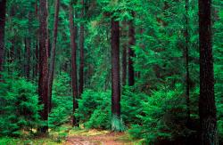
Polish forests
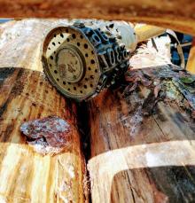
 fot. Paweł Fabijański
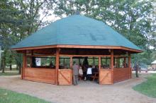
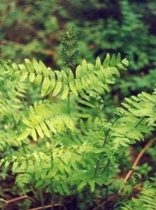
 fot. Paweł Fabijański
 fot. Paweł Fabijański
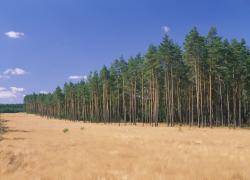
Poland is in the European lead, while concerning the area of all forests. They cover about 29,2 % of the country territory, and grow within the area of 9,1 million hectares. The overwhelming majority of the forests is state owned, of which almost 7,6 million hectares are managed by the State Forests National Forest Holding..
The number of Polish forest is still growing. The forestation rate of the country has increased from 21 % in 1945 to 29,2 % at the moment. Between 1995 and 2008, the forest area increased by 310 thousand ha. The basis for afforestation works is the "National Programme for Increasing the Forest Cover" (KPZL), assuming an increase of the forestation rate up to 30 % by 2020 and up to 33 % by 2050. Polish forests abound in flora, fauna and fungi. 65 % of the total number of animal species live there.
The forests grow in our country on poor soils, mainly because of the development of the agriculture in previous years. It influences the distribution of the types of the forest sites in Poland. Over 55 % of the forest areas is covered with coniferous forests. In other areas, there are forest sites, mainly the mixed ones. Their small part constitute alder and riparian forests – not more than 3 %.
In the years 1945 – 2011 the area of natural deciduous tree stands within the area of the State Forests National Forest Holding increased from 13 to 28,2 %.
Within the lowlands and uplands the most often occurring tee species is pine. It covers 64,3 % of the forest area of the State Forests National Forest Holding and 57,7 % of private and commune forests. In the mountains the predominant species is European spruce ( in the west) and European spruce with beech (in the east). Domination of pine is the result of carrying on sustainable forest management in the past. Once, the monocultures (crops or cultivations of one species) were the answer to the great demand of industry for wood. Such forests appeared to be quite fragile to climatic factors. They also were often the prey of pests' expansion.
In Polish forests, the share of other tree species, especially deciduous trees have been systematically increasing. The foresters have stepped aside from monocultures – that is why, they try to fit specific species of the forest stand to the natural stand, that would be proper for the given area. Thanks to that, in the years 1945 – 2011, the area of the deciduous tree stands within the lands of the State Forests National Forest Holding increased from 13 to 28,2 %. There occur more and more frequently the following tree species: oaks, ashes, maples, sycamore maples, elms, but also birches, beeches, alders, poplars, hornbeams, aspens, tilias and willows.
Our forests are the most often represented by the forest stands aged 40 to 80 years. The average age of the forest equals 60 years. More and more trees are of big size at the age over 80 years. Since the end of the Second World War, the forests' area has increased up to almost 1,85 million hectares.
Raport o stanie lasów w Polsce 2012

Asset Publisher
Mapy lasów teraz zawsze pod ręką
Mapy lasów teraz zawsze pod ręką
 Fot. Shutterstock.com

Teraz wybierzesz się łatwiej na wycieczkę do lasu.
Na zlecenie Lasów Państwowych została przygotowana aplikacja umożliwiająca dostęp do map lasów. Aplikacja mBDL (mobilny Bank Danych o Lasach) już można pobrać na telefony i tablety z systemem Android.
Podstawową zawartością aplikacji są leśne mapy tematyczne np. mapa podstawowa, drzewostanowa, form własności, siedlisk leśnych, zbiorowisk roślinnych oraz mapa łowiecka.
Poza mapami branżowymi, użytkownik ma możliwość wyświetlenia np. mapy topograficznej lub ortofotomapy lotniczej/satelitarnej, a także map z zewnętrznych serwisów WMS.
Adresy najpopularniejszych serwisów, np. dane o charakterze katastralnym, ortofotomapa czy serwis GDOŚ, są zapisane w aplikacji na stałe, co ułatwia ich wykorzystanie. Inne, dowolne serwisy WMS można podłączyć wpisując konkretny adres URL, który jest następnie zapamiętywany w aplikacji.
Po wcześniejszym pobraniu odpowiednich danych, aplikacja działa również offline.
Mechanizm pobierania danych do pracy offline umożliwia korzystanie z map nadleśnictw oraz parków narodowych. Razem z mapami, które zapisywane są w postaci rastrowej, dla lasów LP pobierane są dane wektorowe z atrybutami opisowymi.
Z poziomu aplikacji mBDL użytkownik ma dostęp w trybie online do pełnego opisu taksacyjnego dla lasów wszystkich form własności. Opis taki zawiera m.in. gatunki drzew i krzewów występujące w danym miejscu, ich szczegółowy opis, adres leśny, wskazania gospodarcze i wiele innych informacji.
Aplikacja wyposażona jest dodatkowo w szereg przydatnych w terenie funkcjonalności: zapis punktu z lokalizacji GPS lub ze wskazania na mapie, zapis trasy oraz prostą nawigację do wskazanego punktu. Zapisane punkty i trasy można wyeksportować w postaci pliku KML, przesłać na inne urządzenie lub zaimportować na inne urządzenie, na którym też jest zainstalowana aplikacja mBDL.
W mBDL można wyszukać wydzielenia leśne na podstawie tzw. adresu leśnego. W menu Pomoc dostępna jest również instrukcja opisująca podstawowe funkcjonalności, z którą warto się zapoznać na początku użytkowania aplikacji.
Zapraszamy do korzystania z naszej instrukcji obsługi mBDL przygotowanej do poszukiwania miejsc bushcraftowych czyli OBSZARÓW PILOTAŻOWYCH BUSHCRAFT-SURVIVAL, poniższą instrukcję można wykorzystać do określania miejsc postojowych, ścieżek edukacyjnych w kaliskich lasach i nie tylko.
Aplikacja została przygotowana przez Biuro Urządzania Lasu i Geodezji Leśnej.